


|
|
|
|
 |
Free RV Camping - Ajo, Arizona |
| RV Camping Home | RV Products/Supplies | Discount Camping | Boondocking | FAQ | Contact |
| RV Rentals | Public Lands | RV Clubs | RV Parks | Camping Tips | RV News |
Free RV Camping and Location Maps for Ajo ArizonaThese maps are provided to assist you in finding RV camping locations. Locations displayed are approximate, and are offered only as a guide and should not be used for navigation. Public lands are administered by USA and state government departments, and you should consult with the local public land management office for specific RV camping and access information if you are unsure of local policies. To find free RV camping sites, you need a good map. We recommend Benchmark Maps for Arizona as a great paper recreation atlas. Put that together with DeLorme Topo 6.0 Software and you have a versatile set of tools to find RV camping sites all across Arizona. Ajo Arizona LocationThis is the approximate location of Ajo within Arizona. Surrounded by BLM (Bureau of Land Management) administered lands, Ajo offers RV camping locations in a remote desert setting. Click on the map for more information about RV camping opportunities. The following map
shows only one of many free RV camping
locations around Ajo. BLM (Bureau of Land
Management) administered lands offer dispersed RV camping.
Purple
shaded area of map is BLM public lands available for RV camping.
Cabeza National Wildlife Refuge (NWR)
The Cabeza Prieta
National Wildlife Refuge is the third largest NWR in the lower 48
states. Dispersed RV camping is allowed throughout the
refuge, but you must obtain a permit first from the refuge headquarters
in Ajo. Keep in mind that these locations are very
remote, but if you are seeking solitude, you will find it within the
NWR boundary. The following map shows only a few
RV camping locations available. Detailed location maps are
also available at the NWR headquarters.
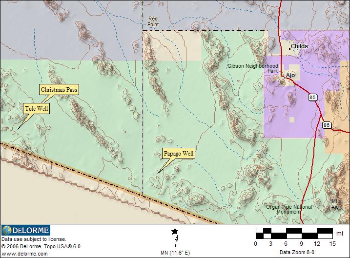
The
purple shaded areas are BLM (Bureau of Land Management) administered
lands, the blue shaded area is Barry Goldwater USAF test range, and the
green shaded area is the Cabeza Prieta National Wildlife Refuge.
RV Camping Information You Can UseThe location map images for finding RV camping locations around Ajo, AZ are derived from DeLorme Topo 6.0 Software and used with their exclusive permission. These map images only display a very limited area. DeLorme's Topo 6.0 covers the entire USA with highly detailed maps that can be zoomed in or out, moved, printed, and interfaced with GPS units. 3-D views, tracking and route planning, as well as map annotation ability are included. BLM administered lands are available free with registration of the program.Return to RV Camping - Arizona |
|||||
 |
| Copyright © www.rv-camping.org - All Rights Reserved |