California RV Camping – Borrego Springs
RV Camping and Location Maps for Borrego Springs
There are 3 RV camping location maps on this page
These maps are provided to assist you in finding RV camping locations near Borrego Springs, California. Locations displayed are approximate, and are offered only as a guide and should not be used for navigation. Public lands are administered by USA and state government departments, and you should consult with the local public land management office for specific RV camping and access information if you are unsure of local policies.
To find free RV camping sites near Borrego Springs, you need a good map. We recommend Benchmark Maps for California as a great paper recreation atlas. Put that together with DeLorme Topo 6.0 Software and you have a versatile set of tools to find great RV camping sites.
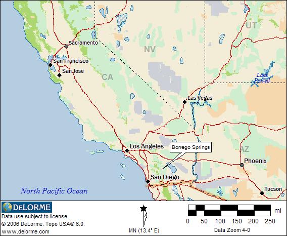
Borrego Springs Location
This map shows the general location of Borrego Springs. The Anza Borrego State Park allows RV camping in organized and dispersed areas. Click on the map for more information.
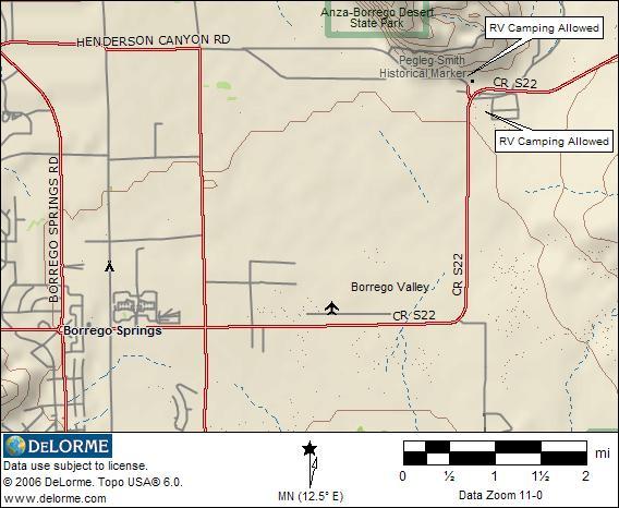
Free RV Camping Locations
This map shows 2 RV camping locations in the Borrego Springs Area. State owned land surrounds the town, and there are several places to camp if you explore beyond the sites shown on this map. The areas shown will accomodate any size RV, and there is no maximum length of stay posted. Groceries, food, fuel, RV dump, trash, water and more are available in Borrego Springs.
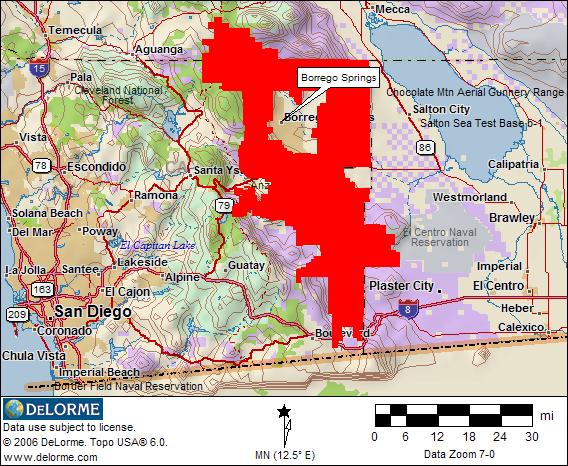
Anza Borrego State Park
The red area of this map shows the Anza Borrego Desert State Park. You can click on the map below to go the official state park web page. RV camping is allowed, and there are free dispersed camping areas as well near Ocotillo Wells.
RV Camping Information You Can Use
The location map images for finding RV camping locations near Borrego Springs California are derived from DeLorme Topo 6.0 Software and used with their exclusive permission. These map images only display a very limited area. DeLorme’s Topo 6.0 covers the entire USA with highly detailed maps that can be zoomed in or out, moved, printed, and interfaced with GPS units. 3-D views, tracking and route planning, as well as map annotation ability are included. BLM administered lands are available free with registraton of the program.
Return toCalifornia RV Camping