High-Tech-Campsite-Searching
Using High Tech Tools to find Dispersed Campsites (Boondocking)
Dispersed camping (boondocking) is defined as camping outside a developed campground. This type of camping is available on public lands throughout the US, especially in the west. Margie & I prefer this type of camping to RV parks and other developed campgrounds, and have years of experience finding great remote campsites.
I use USGS (United States Geological Survey) maps, and DeLorme Topo 6.0 software, but recently a post on an RV forum about using Google Earth as a tool for finding boondocking locations caught my eye. I’d looked at Google Earth when it was first released but had mixed feelings.
Since it had been several years, and a couple computers since I had used Google Earth, I decided to download the free satellite image application and have a look to see if it would help find dispersed camping locations. My experiment covered just a small section of BLM public land near Mammoth Lakes, California. I compared/combined USGS maps, DeLorme Topo 6.0 software, Benchmark Road & Recreation Atlas, & added Google Earth for visual confirmation. My search is always for a suitable remote campsite for our 36 foot Class A motor home. We are more adventurous than most RVers as far as where we are willing to take our motor home.
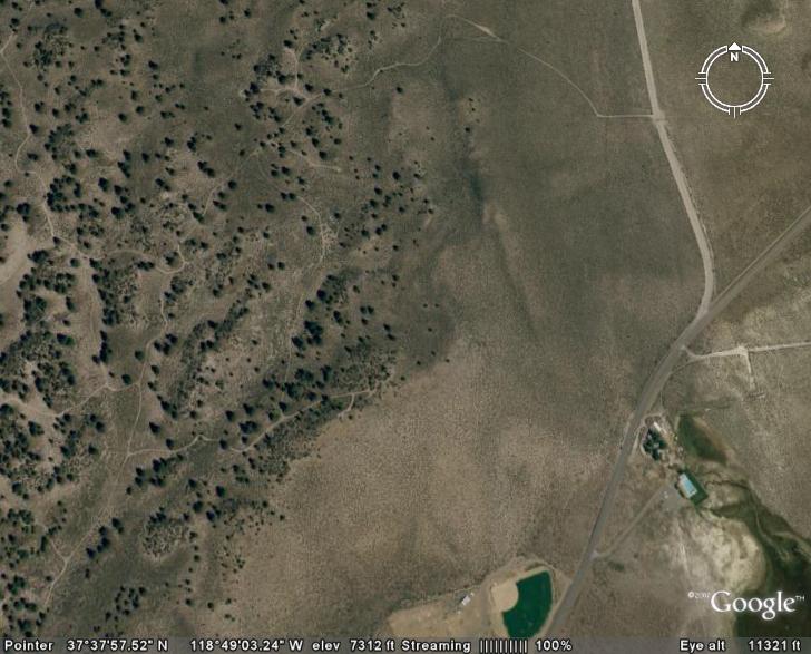
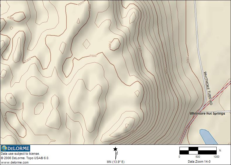
The following two maps show Google Earth satellite image, and DeLorme Topo 6.0 map image of the same area. You can clearly see trails and trees in the the Google Earth image.
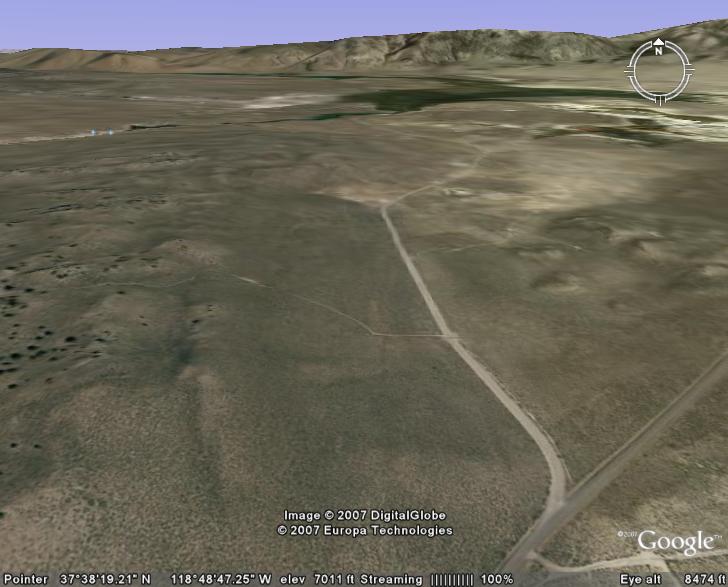
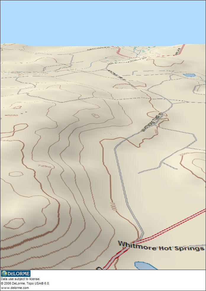
The next images two are Google Earth 3D and DeLorme 3D map images of the same location.
Conclusion – My Humble Opinion
I could have used any of the maps mentioned without Google Earth, and saved a lot of time campsite searching. On the other hand, I fell in love with Google Earth. I discovered that this public land area has numerous roads/trails that show up clearly on Google Earth, including what appeared as pull-thru campsites that are not mapped by USGS, DeLorme, or Benchmark. Google Earth images show forest density, and really made me want to find a campsite in the area.
In this case, Google Earth led me astray looking for access to these great appearing campsites as there is no possible way to get our motorhome anywhere near where we wanted. Getting our modified Jeep into this area was very difficult, and once we did find an access road, it was far from suitable for our Class A.
So what did I learn? Using Google Earth along with DeLorme Topo 6.0 or other suitable topographical maps will provide the best advance campsite location research tools. Once you begin to understand all that Google Earth will do, combined with advanced 3D mapping of DeLorme Topo 6.0, you have a powerful set of tools for pre-searching dispersed campsites. None of the above map tools offer exact public land boundary information, so being sure you are on public land is difficult. By comparing Topo maps to the actual satellite imagery, you should be able to get a pretty good feel for topography on the ground. Roads not mapped but that show up on Google Earth are probably not suitable for RV use.
I doubt there will ever be a substitute for actual on the ground exploration when looking for RV dispersed campsites, but new technology can help you find interesting places. We discovered an abandoned air field exploring once, and that airfield is not on any maps we’ve found. Using Google Earth, you can easily find it. When searching for new places to camp, give the new technologies a try, they can help you find some great RV camping locations.