California RV Camping – Hollister
Free RV Camping Location & Maps – Hollister, California
There are 2 RV camping location maps on this page
These maps are provided to assist you in finding RV camping locations near Hollister California. Locations displayed are approximate, and are offered only as a guide and should not be used for navigation. Public lands are administered by USA and state government departments, and you should consult with the local public land management office for specific RV camping and access information if you are unsure of local policies.
To find free RV camping sites in the Hollister area, you need a good map. We recommend Benchmark Maps for California as a great paper recreation atlas. Put that together with DeLorme Topo 6.0 Software and you have a powerful set of tools to find RV camping sites.
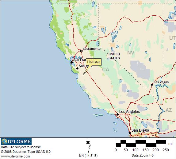
Hollister Location
This map shows the general location of Hollister, California. Dispersed RV camping is allowed on Bureau of Land Management (BLM) administered lands. Click on the map for the official BLM web site.
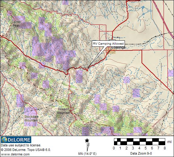
Free RV Camping Locations
The following map shows dispersed RV camping (boondocking) area near Hollister.
The following directions are provided by the BLM (Bureau of Land Management)
From the San Jose area, travel south on Highway 101 to Gilroy. Just past Gilroy, take the Highway 25 exit towards Hollister. Continue through town (Hwy. 25 runs through the town of Hollister) and head south for about 35 miles. You will pass by the Pinnacles National Monument. Turn left onto the Coalinga-Los Gatos Creek County road. Continue approximately 14 miles. At the BLM sign indicating the entrance to the Clear Creek Management Area, turn left. You will then be on the main road, Clear Creek Road, which is an unpaved road bisecting the Management Area. From Coalinga, take the Coalinga-Los Gatos Creek County Road to the turn-off to the Management Area, which will be a right-hand turn. From I-5, take the Panoche Road exit, and head west approximately 25 miles (the road turns to dirt within 2 miles of the highway, and turns back to pavement again after 14 miles). Continue on Panoche Road to the Idria Road, and left. This road will lead you to the north entrance of the Clear Creek Management Area. As of 9/97, there is a washout on this main road as you enter the Management Area. Travelers are advised to take a detour on the “Aurora Mine Road”, which will bypass the washout.
RV Camping Information You Can Use
The location map images for finding RV camping locations near Hollister California are derived from DeLorme Topo 6.0 Software and used with their exclusive permission. These map images only display a very limited area. DeLorme’s Topo 6.0 covers the entire USA with highly detailed maps that can be zoomed in or out, moved, printed, and interfaced with GPS units. 3-D views, tracking and route planning, as well as map annotation ability are included. BLM administered lands are available free with registration of the program.
Return to California RV Camping